

Industrial Development & A Sinking City
Historians believe that the fluctuations of the River Indus had a major impact on Mohenjo-daro, an archaeological site in Larkana District of Pakistan’s Sindh Province. Built in BCE 2500, it was the largest settlement of the ancient Indus Valley Civilisation and one of the world’s earliest major cities, contemporaneous with the civilisations of ancient Egypt, Mesopotamia, Minoan Crete and Norte Chico. The river whipped back and forth across the plains, causing floods that destroyed the agricultural base of the city. Trade, as well as the economy, were also disrupted as hundreds of villages might have been destroyed by floods or by rivers carving new channels.
In its latest report, the Intergovernmental Panel on Climate Change (IPCC) has mentioned that coastal Indian cities, like Kolkata, Mumbai and Surat, could be submerged by rising sea levels by the end of 2100, if the South Asian nation fails to tackle the climate crisis in a proper manner! The UN body that assesses Climate Change Science has further mentioned that several countries have changed their capital cities in recent times because of this. On August 27, 2024, Indonesia moved its capital from Jakarta to Nusantara, a new city being built in East Kalimantan on Borneo Island. The new capital is intended to reduce the burden on Jakarta that is sinking and prone to flooding. The northern part of Jakarta has sunk more than 16ft in the last 25 years! With this, it has become the world’s fastest-sinking megacity. As per statistics, the global average sea level has risen 8-9 inches (or 21-24 centimetres) since 1880 due to Global Warming. In 2023, global average sea level set a new record high – 101.4mm (or 3.99 inches) above the 1993 levels. Meanwhile, the land subsidence rate in the coastal areas of Jakarta is around 11-12cm per year!

The sea water has entered the northern port area of Jakarta. One can experience this by entering the Batavian Marina (or Batavia Sunda Kelapa Marina), the name given by the colonial Dutch rulers. As there is a rise in canal water level near the harbour road area in North Jakarta, the concerned authorities have made an attempt to stop the water from submerging the main city with concrete guards and sand-bags. The scenario has also prompted the government to move the capital to Nusantara, 1,600km away from Jakarta. Nusantara is located between Kutai Kartanegara Regency and Penajam North Paser Regency in East Kalimantan on the island of Borneo.
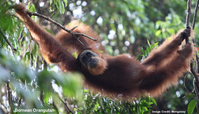
It may be noted that the Equator divides Borneo, the third-largest island in the world, into the Northern and Southern Hemispheres. The island is politically divided among three countries, Indonesia, Malaysia and Brunei. While approximately 73% of Borneo is Indonesian territory, the eastern Malaysian Provinces of Sabah and Sarawak make up about 26% of the northern part of this island. The Malaysian federal territory of Labuan, too, is situated on a tiny island just off the coast of Borneo. Nusantara is surrounded by dense rainforests, where one can find a number of critically endangered species, including the Bornean Orangutans. Hence, the Nusantara project could affect the local ecosystem, creating troubles for those species.
Meanwhile, the Government of Indonesia, which deployed nearly 0.2 million workers, engineers and architects to build the new capital at an estimated cost of USD 35 billion, has assured that only electric vehicles would be used in Nusantara and a 50MW solar power project would be built there by the end of 2030. However, the assurance is yet to convince the environmentalists.
In fact, Sukarno (June 6, 1901 – June 21, 1970), the first President of Indonesia, planned to move the capital from Jakarta to Palangka Raya (also on Borneo) way back in 1957 mainly because of population growth and flooding. Jakarta is not the only city in the world to face this problem. Other densely populated cities, like Bangkok, Yokohama or Mexico City, are also facing a similar crisis.

Geologists have identified the negative impact of human activities on the global environment and also on ecosystems in the post-industrial era as one of the major factors responsible for topographic changes. They have further identified this period as Anthropocene, a proposed geological epoch that describes the period of time when human activities have had a significant impact on the Earth. A number of capitals and major coastal cities of Southeast Asia are situated on deltas. Naturally, these regions have several river estuaries, both large and small, and there are 13 such rivers in Jakarta!
In such a landscape, the concerned authorities have turned urban areas into concrete jungles by filling the basins, cutting trees and building high-rises in order to meet the growing demands of urbanisation. Floods have become quite frequent in the tropics, with Global Warming triggering more rainfalls in this region. However, there are very few countries as beautiful as the Indonesian archipelago that have both mountains and sea. Although the economic inequality (between the super-rich and the poor) has increased dramatically in the majority of countries over the past three decades, it has decreased in Indonesia! However, one can blame the Post-Liberal Capitalism for the sinking of Jakarta.

The policy of development by balancing the economic, social and environmental needs is called Sustainable Development. If the international community fails to ensure sustainable development right now, then a number of cities shall be submerged in various parts of the globe in near future.
Latest Release: Tegart’s War: A Story of Empire, Rebellion and Terror by Stuart Logie
Available on Amazon, Amazon India and Kindle

Boundless Ocean of Politics on Facebook
Boundless Ocean of Politics on Twitter
Boundless Ocean of Politics on Linkedin
Contact us: kousdas@gmail.com
